
 Click around on all the images,
 but particularly on the high-resolution
satellite photo of Tungurahua.
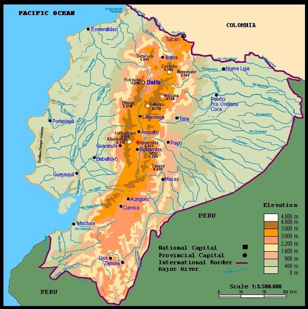
Here are some images of and associated with Planet Earth's most violent volcano at the moment, Tungurahua, in the Andes in Ecuador. The red dot shows Tungurahua on the Ecuador map.
Just to put things in perspective, human beings are totally powerless and ineffective against volcanos. We could drop hydrogen bombs down a volcano's throat and the volcano would give no evidence of having noticed. We're not even very good at predicting their behavior in the short-term future.
The one thing we are getting better at is quantitative, empirical observation of volcanic and seismic activity, which we can use to do the only thing we can do which has positive, life-saving benefit: Warn people when to flee.
The volcano chooses its century or millennium to sleep. Then it chooses its own moment to wake up, often with less than a day's warning. Sometimes the people fleeing for their lives, who had lived near the volcano all their lives, didn't even suspect the mountain was a volcano. Vulcanologists probably aren't very confident about describing a volcano as either dormant, extinct or inactive. Only the volcano really knows if it's dormant, extinct or inactive. Maybe it was extinct. But then it changed its mind.
An immediate consequence of volcanic activity is the disruption, over a huge area of the planet's surface, of all air travel. Not only does the volcanic ash seriously degrade aviation visibility, but jet engines can encounter a sudden cloud of ash -- rock powder -- and shut down in flight. On Montserrat, the Soufriere volcano delivered the added insult of destroying the island's only airport, though a new airport, hastily built on the safe northern part of the island, has re-opened. The economic impact of an awakening volcano can be catastrophic and long-lasting. With only guesswork about the future to guide them, governments, insurers and financial institutions are exremely reluctant to pump money into a place that was just destroyed by a volcano and associated earthquakes.
Ironically, though the ash can destroy and disrupt agriculture for several years, the ash and lava spewing from a volcano are the raw material of incredibly rich, fertile new soil. The volcano destroys life and at the same instant the volcano creates life.
These are just ordinary, garden-variety deadly volcanos. Don't ask me about the Yellowstone Caldera, or Cumbre Vieja. You don't want to know about that. Don't even bother packing a bag. Think of Mother.
=============
IG [Instituto Geofísico-Escuela Politécnica Nacional] reported that during 21-27 March [2007], constant emissions of ash and steam from Tungurahua produced plumes that rose to altitudes of 7-10 km (23,000-32,800 ft) a.s.l. and drifted mainly W, NW, and N. Ashfall was reported from areas downwind and from areas SW within 8 km, on all days except 25 and 27 March. Noises resembling "cannon shots" and blocks rolling down the flanks were heard on 21, 22, and 25 March; windows rattled as far away as 11 km N in Guadalupe. On 23 March, lahars traveled mainly down NW gorges and affected the roads between Ambato and Baños, and between Baños and Penipe.
Sources: Instituto Geofísico-Escuela Politécnica Nacional - "Report provided courtesy of the Smithsonian's Global Volcanism Program and the US Geological Survey's Volcano Hazards Program."
==================
Tungurahua is an active stratovolcano also known as the "The Black Giant." It is a steep-sided andesitic-dacitic stratovolcano that towers more than 3 km above its northern base, is one of Ecuador's most active volcanoes. Three major volcanic edifices have been sequentially constructed since the mid-Pleistocene over a basement of metamorphic rocks. Tungurahua II was built within the past 14,000 years following the collapse of the initial edifice. Tungurahua II itself collapsed about 3000 years ago and produced a large debris-avalanche deposit and a horseshoe-shaped caldera open to the west, inside which the modern glacier-capped stratovolcano (Tungurahua III) was constructed. Historical eruptions have all originated from the 600 ft. (183 m) wide summit crater. They have been accompanied by strong explosions and sometimes by pyroclastic flows and lava flows that reached populated areas at the volcano's base.
Tungurahua causes many tremors in the nearby city of Baños. Tungurahua's lava is mostly composed of basalts. Tungurahua has had at least seventeen eruptions in historical times Prior to a long-term eruption beginning in 1995 that caused the temporary evacuation of the city of Baños at the foot of the volcano, the last major eruption had occurred from 1916 to 1918, although minor activity continued until 1925.
==================
about the image from space:
==================
Tungurahua Volcano
in Ecuador
Image Acquired: 16 October 2006
The Tungurahua Volcano in Ecuador underwent a severe eruption in August 2006, followed by intermittent eruptive activity over the next couple months. On October 16, 2006, the Advanced Spaceborne Thermal Emission and Reflection Radiometer (ASTER) on NASA’s Terra satellite captured this image of the volcano as it released a plume of volcanic ash.
This false-color image was created by combining shortwave infrared, near-infrared, and green wavelengths of light observed by ASTER. The image clearly shows not only current volcanic activity, but also the results of earlier eruptions. Deep purple rivulets of rock carve through the bright green vegetation. The rock results from previous lava flows that later solidified. Similar in color to the hardened lava are geometric patches of bare ground on the volcano’s slopes, some of the numerous settlements in the area.
The Chambo River makes a bright blue ribbon along the western edge of the volcano. Pyroclastic flows of rocks, ash, and other volcanic materials temporarily dammed the Chambo River in August 2006, and the purple remains of earlier eruptions cross this river in the west and the north. At the volcano’s summit is a glowing red dot, indicating an area of intense heat. The ash cloud in this image appears bright purple, in contrast with the white clouds to the northwest.
Image courtesy of Nick Smith and Matt Patrick, Michigan Tech University; and Patricia Mothes, Instituto Geofísico, Escuela Politécnica Nacional.
================
Monitoring Volcanic Eruptions
with a Wireless Sensor Network
Geoffrey Werner-Allen, Matt Welsh
Harvard University
Jeff Johnson
University of New Hampshire
Mario Ruiz
UNC and Instituto Geofísico, EPN
Jonathan Lees
UNC
Paper accepted to EWSN '05. This is the camera-ready version.
We deployed a wireless sensor network to monitor eruptions at Volcán Tungurahua, an active volcano in central Ecuador. This network consisted of five tiny, low-power wireless sensor nodes, three equipped with a specially-constructed microphone to monitor infrasonic (low-frequency acoustic) signals emanating from the volcanic vent during eruptions. We gathered over 54 hours of continuous infrasound data, transmitting signals over a 9 km wireless link back to a base station at the volcano observatory.
Composed of small, low-power wireless devices, sensor networks constitute a new kind of computing platform. A typical wireless sensor network platform, or "mote", integrates a computationally-limited processor and limited storage capacity with an flexible interface allowing various sensors to be attached. The energy, memory, computation, and bandwidth limitations of sensor network devices pose system design questions that require continued research if robust deployments are desired.
To date, habitat, medical, and structural monitoring applications have been deployed on sensor networks. To our knowledge this is the first dense wireless array deployed for volcanic monitoring.
Background
Volcanologists collect seismic and infrasonic signals to monitor and study volcanic activity. Volcanos emit powerful seismic waves while erupting; but tectonic earthquakes, mining operations, and ambulating quadripeds can also induce seismic energy, complicating eruption detection based on seismic events alone. Because volcanos also emit powerful pulses of infrasonic energy near the moment of eruption, in cases where visual monitoring is impossible, inconvenient, or dangerous, correllating infrasonic and seismic events provides better eruption detection than either taken alone. Additionally infrasonic signals provide additional informational content not found in the seismic data.
Wireless sensor networks consist of small, low-power devices equipped with a radio, a variety of sensors, and a modest amount of computational power and local storage. A typical sensor "mote" is powered by 2 AA batteries and includes an 8-bit microcontroller, 4 KB of memory, a low-power radio with a range of approximately 100 meters and a bitrate of about 38 Kbit/sec. The low cost, size, and energy requirements of sensor networks makes them very attractive for volcanic monitoring. Our small array of infrasonic sensors monitored volcanic eruptions, reporting real-time data over a wireless link to a base station. A larger infrasonic array consisting of dozens of motes could be used to eliminate sources of noise as well as to triangulate the source of an eruption event.
Volcán Tungurahua
Tungurahua (map) is an active volcano in central Ecuador, near the town of Baños. The Instituto Geofísico of the Escuela Politecnica Nacional (IG-EPN) in Quito maintains an observatory near the volcano that is responsible for monitoring eruptions and apprising the government and media of changes in eruptive activity. Dormant for over 80 years, in 1999 Tungurahua began showing increased seismic activity which led researchers to believe that the volcano was awakening. Baños was evacuated by the Ecuadorian military in anticipation of a large event, which did not in fact occur. After several months the populace of Baños was allowed to return to their homes. Since then the volcano has been experiencing a period of increased eruptive activity, making it an ideal candidate for volcanic research.
This collaboration between researchers at Harvard, UNH, IGEPN, and UNC resulted in the deployment of a wireless infrasonic sensor network at Volcán Tungurahua from July 19-23, 2004. During this time, the volcano was erupting at the rate of several small or moderate explosions an hour, though the rate and energy of eruptions varied considerably. Our sensor network recorded over 54 hours of data from three wireless infrasonic microphone nodes, relaying the data back to the observatory over a 9 km radio link. A laptop at the observatory recorded the complete data traces and visualized the signals in real time. The wireless sensor array was colocated with a wired monitoring station recording infrasound and seismic signals, allowing us to verify our signals against an trusted monitoring platform.
Equipment
Five Mica2 sensor network devices performing three different tasks composed our volcano monitoring network: three data-collection motes fitted with custom-built infrasonic sensors, one receiver mote forwarding data over a long-range serial point-to-point link, and one time synchronization mote interfaced to a GPS unit providing a common time base for the data collection elements.
The three data-collection motes integrated the Mica2 with an infrasonic microphone (Panasonic BM-034Y) and custom amplification and filtering circuitry. Sampling at approximately 102 Hz, they transmitted data packets containing multiple readings to the receiver mote at approximately 4Hz. A Mica2 receiver mote attached to a MIB600 interface board forwarded data packets along a long-range serial point-to-point link, provided by a pair of FreeWave modems fitted with 9dBI directional Yagi antennas, back to the observatory 9 km away. A laptop connected to the FreeWave modem at the observatory logged the data and provided real-time monitoring capabilities.
To provide the required common time base for the data-collection motes, an additional Mica2 mote was interfaced with a off-the-shelf Garmin GPS receiver. The time synchronization mote receives a time pulse every second from the GPS unit and relays the pulse to the infrasound motes via radio. Each mote marks the infrasound sample taken when each GPS timepulse is received, allowing the signals from each mote to be synchronized across time.
Equipment pictures:
The sensor node software was implemented in TinyOS, a tiny operating system for sensor networks. Laptop software was implemented in Perl and Java running on the Linux operating system.
Through the deployment the Freewave Modems and GPS receiver were powered by standard 12 Volt car batteries, a readily available energy source in Ecuador. All other devices were powered by 2 AA batteries. No power sources required replacement over the duration of the deployment.
Data Collection and Analysis
Our wireless sensor network stored 54 continuous hours of infrasonic data into approximately 1.7 GBytes of uncompressed log files. During that time several sets of eruptive pulses were recorded. We are continuing to analyze the data we recorded, comparing it against signals recorded by several different wired monitoring stations. Displayed below are one set of traces from our wireless sensor network compared to two different wired stations: one co-located with our deployment and the other at a different site on the volcano. Note that the wired Larson-Davis microphone signals shown have inverted polarity.

2 comments:
I recently came across your blog and have been reading along. I think I will leave my first comment. I don’t know what to say except that I have enjoyed reading. Nice blog. I will keep visiting this blog very often.
hey Lots in Costa Rica --
bienvenidos a Vleeptron!
while i got you on the line ... Costa Rica REALLY has No Army??? ¿La verdad?
Nice Trick! Me gusta!
Anyway, glad you like the Tungurahua post. I have a Psychological Problem, I love violent dangerous volcanos. I visit them whenever I can. Soy loco por los volcanos salvajes.
(Sorry mi espan~ol sux so bad.)
Costa Rica got any volcanos? Extinct, dormant, active? (Doesn't matter, the dead volcano will come back to life whenever the heck it wants to.)
¿Como se dice "FLEE FOR YOUR LIVES!!!" ? I don't want to be standing around in my Bermuda shorts with my Sony camcorder and not know where everybody's going.
Bob
Post a Comment